Malaysia Airlines (MAS) Business Class review

business class check in

MAS Business Class seats were the only ones available for my trip home since Economy class tickets have all been taken up. I decided to go for Business Class instead and expected to pay double the fare. However, my ticket agent told me that it’s only a surcharge of RM 30 per route. It seems that Business Class for short haul domestic flights (30 minutes) is not as expensive as I thought. I’ve always looked at the people seated in front with a little contempt (what’s the point in having a premium ticket for a short haul flight?) and now, I have become one of them. Alas!

business class martina

However, it seems that there are perks to Business Class seating in short haul domestic flights after all. First of all, I noticed that the ground staff damn chun. This is Martina, the Coordinating Agent for First Class/Business Class check in. There is also usually no line at the First Class/Business Class check in counters.

business class boarding

You also have the luxury of not boarding until the rest of sardine class boards coz Business Class seats are to the front and overhead compartment carry on luggage room is assured. There is no First Class on the Boeing 747-200 used to service the Kuching – Sibu – Kuching route.

business class seats

There are four (4) rows of Business Class seats located at the front of the plane. The seats are in two’s with spacious body and headroom being afforded by the 2 x 2 seating (two seats on each extreme side of the plane) in Business Class versus the 3 x 3 seating in Economy Class.

business class pillow

There is a pillow to rest your stiff neck on after a hard day’s work shuffling papers around and delegating tasks or doing whatever it is that people who fly Business Class do.

business class hot towel

Hot towels are provided before takeoff for your freshening needs and a complimentary glass of juice (this is Mango Juice) is furnished to sooth your parched throat after a long day yelling at subordinates for no reason at all. The juice is served in proper glasses, which Business Class flyers are implicitly trusted with, while the standard OJ served as the “refreshment” after take off in Economy Class uses disposable plastic cups, lest they take glassware away (those thieving heathens).

business class papers

Naturally, a selection of our finest English dailies are provided in the seat in front of you, so you don’t have to rush into the plane when you board just to get a copy or nick one from Business Class. πŸ˜‰

business class cabin crew

The cabin attendants in Business Class tend to be more aesthetically pleasing than the ones doing the aisles at the back too.

business class napkins

Snacks and drinks are served with a napkin coz you’re supposed to be more culturally refined. Economy Class passengers do not get food on short haul flights, only the obligatory orange juice.

business class tray

Being the unrefined heathen than I am, I did not realize I was supposed to use the napkin as a tray liner of sorts before eating my sandwich.

business class food

The sandwiches are served on a dish and consist of an egg sandwich, a tuna sandwich and a ham sandwich, with a quarter of a tomato on the side.

business class juice

Business Class grants you access to a variety of free flow juices, which you can drink as fast as possible, before the plane lands…which is pretty quick.

…and you just have to pay RM 1 per minute for this service. πŸ˜‰

]]>

Snorkeling at Manukan Island, Sabah

pulau manukan

Manukan Island or Pulau Manukan is a 20 minute boat
ride from Kota Kinabalu, Sabah. It’s one of the more popular islands in
Sabah due to the attraction of its white sandy beaches and rich hued
waters teeming with marine life. The abundance of corals and
availability of water sports makes this a premier destination for
island hopping in Sabah.

manukan island jetty

Manukan Island is part of the chain of islands that makes up Tunku
Abdul Rahman Park in Sabah, Malaysia. The island can be reached by the
jetty at Kota Kinabalu city. The boat ride costs RM 15 and can
accommodate 10 people, so if you’re in a group that’s less than the
quorum, be prepared to wait a while until 10 people sign up.
One can rent a boat for a day too.

manukan island heading

The boat that takes you to the island is a modern speed boat and it
easily navigates through the clear waters towards the island of your
choice. The boat had a mixture of travelers from all over the world and
the early morning skies were perfect as we headed towards Pulau
Manukan. Snorkels can be rented from the boat operator at RM 10.

manukan island boat

The boats that are allowed to dock at Pulau Manukan has to be
registered with Sabah Parks and it’s required to meet safety
requirements e.g. life jackets must be worn during the journey. The
waterfront of Kota Kinabalu zips by as the boat departs and there is a
constant wind from the speed of the boat billowing at you. The boat
occasionally runs into waves so splashes of water into the boat are
pretty common.

manukan island docking

The lush green island soon comes into view as the boat slows down to
dock at the Pulau Manukan island. The natural beauty of the island is
apparent – calm, green waters with a diverse amount of fishes swimming
around and white, sandy beaches at the fringe with deep green lush
trees lining the island.

manukan island friendly fish

The rich marine life on Manukan Island is apparent as we disembarked
from the boat – the high tide submerges the lower part of the jetty and
people can be seen feeding the fishes with pieces of bread. The island
is a protected zone so no fishing or harming of the marine life is
permitted. This makes the fish breed with abundance and they’re quite
friendly and unafraid of human contact.

manukan island bouys

Pulau Manukan has chalets for overnight stays but most people come
here just to relax and enjoy the natural offerings of the island on a
day trip. The red buoys bobbing around the perimeter extending 100
meters out from the beach are designated swimming areas. There is a lot
of boat traffic outside that demarcation and the speed boats carrying
island visitors frequently passes very close to the line so it’s a good
idea to keep inside the perimeter.

manukan island pier

The Manukan Island pier is a wooden catwalk hovering over the
vibrant green waters and the natural tranquility of the island is
palpable as you walk towards the beach…

manukan island welcome

There is a “Welcome to Pulau Manukan” sign at the end of the pier and a RM 3 conservation fee is to be paid at the booth before entry to the beach is permitted.

manukan island chalet

The chalets nested in lush greenery greet you as you first step on
the beach. The polished wood chalets look perfectly in place on the
island, due to the matching theme and decor of the architecture.

manukan island lets go

I did not waste any time in hitting the beach as the warm sands and
appealing shade of water looks too tempting to resist. I donned my
snorkels and started to float and swim around, appreciating the
wonderful diverse and unique marine life in the waters.

manukan island snorkelling

This is me in the snorkels. The water on Pulau Manukan is incredibly
calm and hosts a wide variety of fishes. I wish I had an underwater
disposable camera to show the readers of sixthseal.com the incredible
scenes that I saw while snorkeling:

There was friendly little swordfish swimming at the top of the water, skimming over my snorkel masks every now and then.

There were many different multicolored fishes which come over
and take bites out of pieces of bread that you offer then, occasionally
nipping at your fingers.

There were sea cucumbers of all sizes, lining the seabed…

There were starfish and corals of mind-boggling variety and complexity.

Since I didn’t have an underwater camera, I had to snorkel out into
the waters to retrieve select pieces of marine life so I can take
photos of them:

manukan island starfish

This is a starfish taken from about 30 meters out to sea. It’s an unusual blue color with a brown underside.

manukan island sea cucumber

OMG! My thing fell off! πŸ˜‰

manukan island corals

This is a piece of the ubiquitous dead corals that wash out onto the
beach. I couldn’t very well lug one from the seabed, so this would have
to do.

manukan island guard

There are lifeguard posts located at the beach for drowning swimmers (though most non-swimmers I saw were wearing life vests).

manukan island beach

The beach at Manukan Island is beautiful – the scenic islands surrounding it are easily visible from the shore.

manukan island waters

The tranquil waters of Pulau Manukan…perfect for snorkeling…

manukan island reading

Reading a good book by the shade of a tree on the beach…

manukan island girls

These are two travelers that I met while I was on Manukan Island – very friendly people, they were snorkeling as well.

manukan island bombs

This is a WWII memorial at Pulau Manukan…there were bombs and
shells on display by the beach, which were presumably recovered on the
beach after the war.

manukan island fishes

The fishes in the water are clearly visible through the calm, green waters…

manukan island leaving

…and all too soon, it was time to depart the island.

Pulau Manukan in Kota Kinabalu, Sabah is a great place to relax and unwind. It’s a great island…

Mount Kinabalu summit – Climbing Lows Peak

lows peak

Mt. Kinabalu is the highest mountain in Borneo. The majestic mountain is also a feature of the Sahah flag and the highest peak is called Low’s Peak,
clocking in at an elevation of 4102 meters. The height of the summit
changes from time to time though, and it’s currently listed as 4095.2 meters.

The climb up began at 0230 hours from the rest house at 3,320 meters
above sea level. We had already scaled the first part of the mountain
earlier and the summit attempt was made after 4 hours of sleep. I was
the only one to reach the top amongst my buddies – one didn’t want to
go and the other gave up half way.

summit attempt

The mandatory guide that was assigned to us woke us up at 2 am in
the morning and I had a quick snack of Pringles and brought along a 1.5
liter bottle of water and several energy bars. The altitude at the
start of the summit climb made the ambient temperature very cold, with
an extremely icy wind chill factor.

I suited up in climbing gear and grabbed a torchlight before
following the guide up the summit at 2:30 am. It is important to wear
gloves as you will need the grip to scramble up the mountain using a
rope and as protection from the rugged granite terrain. The altitude
also makes scaling the mountain difficult and it is important to take
breaths to get used to the thinner atmosphere as you climb up the peak.

dangerous cliffs

The first part of the summit attempt is through rocky terrain and
there are some dangerous areas where the path is narrow and there’s
only a rope separating you from a long fall down the cliff. This isn’t
visible when you climb it as its dark – but watch your step, as some of
the ground is slippery.

km 8

I made good pace and reached the 7 km point with relative ease, so I
told my guide to stay with my friend as he’s moving slower. There were
other groups climbing so I decided to embed myself with the faster
moving groups. It started to get difficult after 30 minutes of climbing
– the weather was extremely cold and my windbreaker couldn’t seem to
keep the cold out. The temperature drops below 0 degrees Celsius at
night and ice forms, though there’s no snow up there.

I started to get altitude sickness again after the first hour and
had to stop frequently to catch my breath. I practically sprawled at
the ground and as I got higher and higher, the more exhausted I got,
and I was close to giving up…except I wasn’t going to give up, so I
just soldiered on and at one point was practically clawing my way up
the jagged rocks by sheer willpower alone.

sayat sayat check point

I finally reached the Sayat Sayat checkpoint (where
you register your summit attempt) and had to take a 10 minute break
there just trying to catch my breath. I don’t usually exercise and
that, compounded by the unfriendly climate and the previous day’s
exhaustion made my summit attempt very difficult. My heart was jack
hammering and I was breathing raggedly, but I was just as determined to
reach the top. πŸ™‚

steep rocky incline

I could barely feel my fingers due to the cold, when I reached the 8
km point, despite the gloves. I met Connie, a Hash House Harrier from
Kuching who asked me if I was alright when she saw me trying to get
warm in a gully. The wind chill factor is a serious concern at this
altitude – I couldn’t ever shield my face from the wind. I decided to
climb steadily without stopping despite my exhaustion and timed my pace
to Connie’s, who’s more experienced.

scaling mt kinabalu

The next few hours passed with a blur and all I remember is the
sharp rock face and the sporadic flash of light from a torchlight as
the climbers scaled up the mountain. It got to a point where I was so
exhausted, my mind went blank and I just forced myself to keep my hands
and legs moving in the general direction of the summit.

It got better as dawn started to break and I could see the peaks of
Mount Kinabalu. That gave me a burst of adrenaline and I started to
climb with more vigor. I didn’t feel exhausted anymore at this point
(probably coz of the endorphins) and marveled at the beautiful face of
Mt. Kinabalu that is starting to reveal itself.

I soon reached the ridge at the bottom of Low’s Peak (the highest
peak in Mt. Kinabalu) and started scaling up the face of the peak.
There is a rope to guide you through the large limestone and granite
peak – it has a very steep inclination and the final 15 meters requires
unassisted climbing, so rock climbing skills would come in useful here.

dawn breaking summit

I managed to pull myself up the steep face of the peak and finally
got to the peak of Mt. Kinabalu just before sunrise. The dawn was
breaking over the mountain and it’s truly a sight to behold…I was
glad I made it to the top. πŸ™‚

Here are some photos from the summit:

summit views

Dawn breaks on the summit of Mt. Kinabalu

summit breathtaking

Breathtaking views of Mt. Kinabalu from Low’s Peak

summit clouds

The clouds below the summit – on the top of the world!

victorias peak

Victoria’s Peak taken from the summit at Low’s Peak

me at summit

Lows Peak – reaching the summit of Mt. Kinabalu

connie

Connie Wu, also from Kuching

connie me summit

Connie and me, taken at the summit

summit wire

Low’s Peak – wire to prevent a fall down the peak

summit ice

Films of ice forming at water pools at the summit

summit rock formations

The beautiful peaks of Mt. Kinabalu as seen from the summit

summit descending

Descending Mt. Kinabalu – the mountain has been conquered!

kinabalu

Download: Mt. Kinabalu summit video [sixthseal.com]

mt kinabalu certificate

Mt. Kinabalu is an impressive granite and limestone mountain and is
a sight to behold in itself. The scenic view at the summit of the
highest mountain in Borneo is breathtaking! I highly recommend scaling
the mountain to anyone who’s visiting Kota Kinabalu, Sabah.

Mount Kinabalu – The Summit Trail

kinabalu drive range

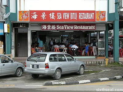
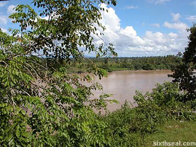
The journey to scale Mt. Kinabalu begins with a one
and half hour drive from Kota Kinabalu to the base of Mount Kinabalu at
Kinabalu Park. There are a lot of scenic views during the ride – the
peak of Mt. Kinabalu is visible at one point.

kinabalu drive clouds

The road traverses through the mountainous area around Mt. Kinabalu
and the ambient temperature cools down noticeably during the ride to
the base of Mt. Kinabalu. The road actually goes above the lower cloud
cover that usually shrouds Mt. Kinabalu, and if you’re lucky, you can
get a magnificent view of the great mountain.

kinabalu park oo

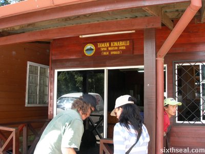
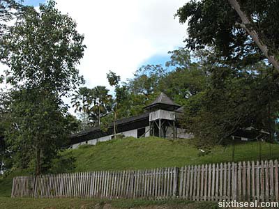
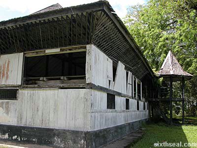
There is an Operations Room at the base of Mt. Kinabalu and it’s managed by Kinabalu Parks, Sabah.
This is where you register your presence (so they’ll know if you fall
off the mountain instead of finding your skeletal remains 3 years later
;)) and get a guide to bring you up to the summit.

kinabalu park wardens

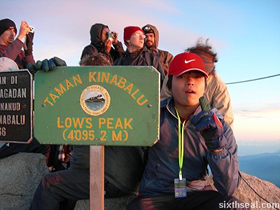
Mount Kinabalu is a World Heritage Site (the first such designated area in Malaysia) and the highest point is Low’s Peak at 4095.2 meters.
It used to be 4101 meters but the summit height seems to change from
time to time, which I find interesting. Mt. Kinabalu is the highest
mountain in South East Asia.

kinabalu park pass

The park wardens at the Operations Room will issue out tags for each
individual – the tag has the climber’s name on it, as well as the date
of registration. There is a short 4WD (SUV) ride to the proper base of
the mountain and that is the point where the climb up Mt. Kinabalu
begins.

mt kinabalu start

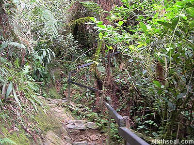
The summit trail begins at Pondok Timpohon where
there is a locked gate to keep out non-mountain climbers (the ones
without a valid pass). It is a 6 km climb (6.5 km to be exact) from
here to the halfway point accommodation that we booked for the night.
This is the easy part of the journey as most of the Summit Trail is
relatively well paved.

summit trail sign

This is a photo of me beside the Summit Trail sign
– I was inappropriately attired coz I didn’t know that we had to climb
to the half-way lodge that day. The “walking stick” can be purchased at
the Pondok Timpohan gate for RM 3. It’s quite useful for hiking up
rough terrain. A torch is also essential for the summit climb, as well
as a suitable (enough for you to drink, but not too heavy for you to
carry) supply of water.

summit trail start

The first kilometer of the Summit Trail is relatively tame, with
(usually) well defined paths and a less punishing incline. The flora
and fauna at this point is similar to what you’ll find at altitudes of
below 1000 meters.

km1 kandis hut

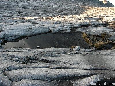
There is a rest hut at about 1000 meters from the start of the summit trail – it’s called Pondok Kandis (Kandis Hut) and there are toilets and untreated (read: undrinkable) water supplies at each rest point.

km1 kandis sign

The rest points (huts) have a short description of the place or an
interesting snippet and also distances to the next rest point, both
ways. Pondok Kandis has the distinction of being located “on the
youngest granite pluton in the world”.

km1 pluton

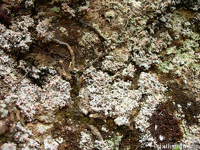
This is a photo of the pluton which is only half a million years
old. I realized the reason Kota Kinabalu is called Api-Api by the
locals then – it’s coz it used to be a volcano.

km1 trail

The next kilometer is more demanding, with more rough terrain and
sharp inclines. The path also starts to become more rocky and harder to
navigate.

km1 sign

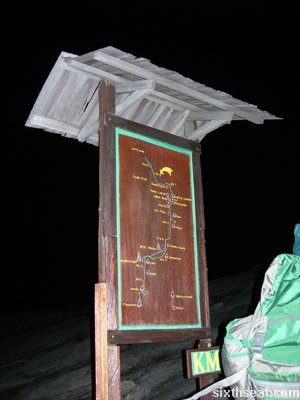
There is a Summit Trail progress sign at every kilometer with a
drawn trail path to show the progress you’ve made so far. It can be a
pain in the ass at times. πŸ˜‰

km1 views

The view starts to become more interesting…the mountain range can
be seen through the trees beside the trail and the ambient temperature
changes subtly as you walk up the summit trail.

pondok ubah

The next rest point is Pondok Ubah (Ubah Hut) at 2081.4 meters above sea level.

pondok ubah sign

The sign states: Moses and ferns grow well in the damp conditions
here and grows luxuriously on the trees here. As you climb the
mountain, the weather gets colder and the soil gets thinner. Fewer and
fewer plant species can survive in these harsh conditions.

moss trees

Sure enough, we saw moss. Moss that grows on trees.

moss furry

Green, furry moss.

moss fungi

White, fungi-like moss.

moss flank

Heck, there’s even moss that seems to grow on the banks of soil that flanks the summit trail…

ferns

There is also a variety of interesting ferns growing along the summit trail as well.

km2 rocky

The terrain on the summit trail gets rockier with rougher edges cut
into the mountain at the 2 km point with a similar drop in temperature
to reflect the higher altitude.

cloud cover

We seem to reach the cloud cover just before the 3 km stop point.
It’s a very interesting experience to watch the clouds float by before
you and into you before dissipating…

pondok low

The next hut is called Pondok Low II (Low’s Hut II
– no idea where Low’s Hut I is) and one notable experience of climbing
Mt. Kinabalu is the friendly people you meet while going up and coming
down. It’s customary to greet fellow climbers with a warm “Hello!”.

pondok low sign

It seems that the summit of Mt. Kinabalu is named after the first
person to reach the highest point of the mountain – Huge Low, 1951.

large ferns

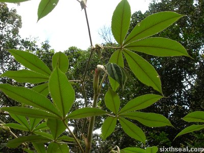
The large (huge – pun not intended) ferns dominate the flora at this point.

fern canopy

The summit trail is covered by a “fern canopy” of sorts, which shades the climber (though at this altitude, it is hardly warm).

fern trees

It seems that the fern canopy is made by fern trees! Jesus, I didn’t know ferns can grow like a tree…

unpredictable path

The trail also tapers off into unpredictable and narrow stone paved paths…

stony ground

It starts to become more challenging to navigate the summit trail at
this point. I was thankful I had the walking stick to avoid unplanned
face first falls into the stony ground.

earthworm transparent

I found an unnaturally large transparent earthworm. I didn’t think it was animate at first…

earthworm retract

…until I touched it and saw it retract into its segmented body length at the contact. It looked like a gross penis.

high altitude fungi

The summit trail keeps on ascending and fungi and other strange plants starts to dominate the plant sphere.

pondok mempening

Pondok Mempening (Dizzy Hut, an appropriately named rest point) lies in the mist shrouded upper echelons of Mt. Kinabalu.

stranger plants

Stranger and stranger plant life forms started to make itself known…

crackers bursting

…and vacuum sealed packets of crackers protested against the
altitude and pressurized, threatening to literally burst. It’s useful
to bring crackers and energy bars (or high energy candy bars like Mars
and Snickers bars) to eat during the climb.

cannabis sativa

Plants that look suspiciously like cannabis sativa was also spotted during the summit climb.

orange fungi

Orange fungi seem to dominate the KM 3 point.

pitcher plants

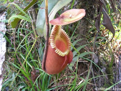
I also took photos of the pitcher plants that grow here. Here’s a
rather nice looking pitcher plant. It looks like a nut sack (to call a
spade a spade) with its furry exterior and sticky liquid material
inside. This one’s for lolanto.

even rockier terrain

The higher parts of the summit trail starts to become uneven rocky
terrain. I know I’ve mentioned this many times, just think of it as
getting harder and harder the higher you climb up. :p

majestic peaks

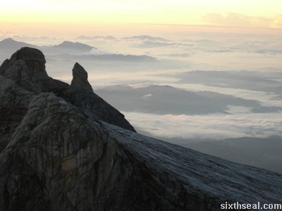
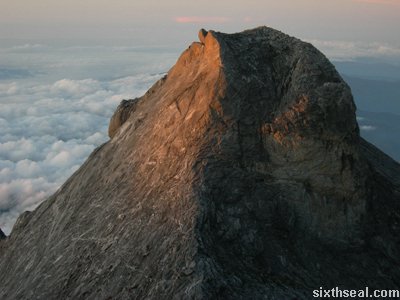
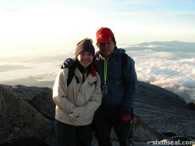
The peaks of Mt. Kinabalu is visible as we pass the canopy cover –
it’s majestic, watching the cloud cover roll lazily past, revealing the
ancient beauty of the mountain.

mountain hardy plants

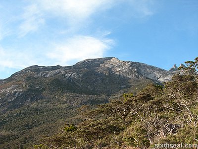
The higher altitude also makes the plants smaller and hardier. The
mountain at the backdrop looks absolutely beautiful. It was tough to go
up the summit trail but the sight of the mountain peaks makes it worth
the effort.

moon rising

The sight of the moon rising as we ascended the summit trail also provides an ethereal quality to the experience…

pondok villosa

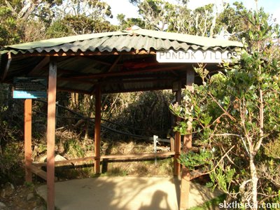
Pondok Villosa (Villosa Hut) states that the strong
wind and the poor soil causes the trees to become dwarfed and gnarled
here. It also states that the despite the gnarled and small look that
the trees have, some of them are several hundred years old.

gnarled trees

The gnarled trees are a main feature of the landscape before we reach Pondok Paka.

pondok paka

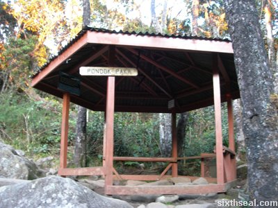
Pondok Paka (Paka Hut) is the last rest point before the first halfway house at Laban Rata.

dark and lost

It was getting dark and I got separated from the group coz I wanted
to go faster (the others could not climb that fast and were slowing me
down) so I decided to go ahead. It was a bad idea as I got altitude
sickness a little while after that and I got confused, dizzy and sleepy
(!). I had to sit down and I honestly thought that I was on the wrong
path and the chilliness of that altitude would make me die of
hypothermia.

raban rata

I managed to stumble along, hoping that I was on the right path (it
turns out that there is only one path, but it’s hard to tell when the
path is rocky and narrow and I didn’t have a torchlight at night), and
I almost rejoiced when I saw lights at the Raban Rata lodge, except I
was too tired and dizzy and just plain sick (felt like throwing up real
bad).

melanie

It’s thanks to Mel from Canada that I managed to get to the Raban Rata
lodge. Much props to her for guiding me up the right path. It’s just
400+ meters, but having altitude sickness is like having a Dramamine
trip – it just fucks up your perception of spatial relationships. I’m
not ashamed to admit that I feared I had lost my way and gone down the
wrong path before Mel came out with a torchlight from her lodge (a
little down from Raban Rata).

aussie couple

Thanks should be given to the Australian couple James and Emily as
well, for being concerned with my well being as I stumbled into the
Raban Rata restaurant, disorientated from the altitude sickness. They
brought me warm water and offered to bring me to their lodge to rest
while I get used to the altitude. Mel also gave me some herbal mints
(that may or may not work, and I didn’t need to take them if I didn’t
want to) which I took (she must have mistaken my nausea for
apprehension at being given pill like mints from unknown origin, not
knowing that I take pills for recreation ;)) and she offered me some
rose scented aromatherapy thing which DID make me feel better. Cheers!

raban rata buffet

I opted for the buffer dinner (RM 22) at Raban Rata (though I could
only pick at my food) and waited for the rest of my group to catch up
(it took them the better part of an hour). I started to get used to the
altitude and gave my thanks to the friendly and helpful folks there
that night (was too sick to do so earlier).

gunting lagadan keys

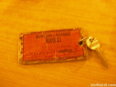
I checked into our room at Gunting Lagadan while waiting for the
rest of my buddies to catch up. Gunting Lagadan Hut is located about
500 meters (that’s a lot at this altitude, so I wasn’t raring to go)
above the Raban Rata restaurant and the hut can fit about 50 people in
rooms of 4 persons each (two double decked beds). It’s about 6.5
kilometers from the base of the mountain.

gunting lagadan

I finally took the hike up to the Gunting Lagadan Hut when my friends came up with the guide,

gunting lagadan showers

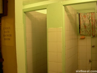
took a quick (cold!) shower,

gunting lagadan beds

and climbed into the bed with my climbing gear ready for the 0200
wake up call from the guide for the final summit climb at 0230 hours.

I was raring to go. πŸ™‚

Zaharah Hotel Apartments, Kota Kinabalu

zaharah RM 75

Zaharah Hotel Apartment is a new Muslim Chinese operated hotel/serviced apartments in Api-Api Center
in Kota Kinabalu. It’s located at the same block and area as Paramount
Service Hotel and Apartments – it seems that the management has rented
out some units to be rebranded as Zaharah Hotel Apartment. Paramount
Service Hotel and Apartments (RM 68++) is all out of their lower end
rooms, leaving only the RM 238++ 3-bedroom apartment suites, so we
decided to look for alternative accommodations and chanced across this
Zaharah Hotel Apartments advertisement for RM 75 nett.

zaharah room

We had just gotten back from Mt. Kinabalu, and being extremally
exhausted, we just took the room and booked it for two nights (RM 150
nett). It’s a very nice deal, considering the excellent service and the
comfortable beds (with clean towels and a new bar of soap on each bed).

zaharah toilet

The toilets are relatively clean and come with an embedded heated
water shower unit. It looks rather like Paramount Hotel and Service
Apartments except that Zaharah Hotel Apartments has…

zaharah mystery room

…a mysterious room which serves no practical or imaginable purpose.

zaharah vanity

Zaharah Hotel Apartments is also equipped with a TV and a vanity
mirror. There is also air conditioning and blinds that leads out…

zaharah balcony

…to a balcony. Nice!

zaharah kitchen

There is also a full fledged kitchen with a fridge, oven/stove top combo and a dish washing area.

zaharah pot

There were also new cooking utensils like pots and so forth and
being so tired, we just cooked dinner in the hotel apartment facilities
and hit the sack.

P/S – I’ve conquered Mt. Kinabalu – it was
torturous and I hurt all over, but it was worth the pain and altitude
sickness. I was the only one in our group to reach the summit and it
was punishing to push myself to the limits, but it was amazing! I will
write about it when I get back – I will have much more resources then.
πŸ™‚

Promenade Hotel Apartments at Api-Api Center, KK

kk airport seas

The flight from Kuching to Kota Kinabalu took about an hour and
half. Kota Kinabalu International Airport is breathtaking when the
plane starts its landing sequence – it goes over the magnificent
islands and austere seas and it almost seems like the plane is going to
land into the sea…

kk airport landing

…but it touched down perfectly on the runaway built right beside the open seas. It certainly is a novel experience…

kk promenade check in

We took a taxi into KK and after walking around a bit, decided to check into Promenade Hotel Apartments at Api Api Center. Api-Api is the word the locals call Kota Kinabalu…interesting snippet here.

kk promenade nook

Promenade Hotel Apartments is located in a nook of Api-Api Center
right in the middle of Kota Kinabalu – it’s all to easy to miss the
place if not for the plethora of signs advertising the low rates of RM
68++ per night.

kk hotel room

Our hotel room is situated a little down from the actual reception
block. This modular hotel apartment design is unique – we had to walk
one block down and take a separate escalator up to the second floor.
The room looks a little dodgy at first sight…

kk hotel corridor

…especially when the corridor seems to be a mix of hotel apartments and business establishments and residential units.

kk hotel interior

The room itself was alright though. There are two beds and a sofa
for the three of us and the room comes equipped with a TV, a fridge and
air conditioning. It also has a kitchen in addition to the bathroom and
toilet unit.

kk hotel view

I can’t say much about the view…

kk hotel ironing carpets

…and it looks like some drug crazed tenant has previously taken a hot iron to the carpets…

…but we’ll only be staying the night.

The journey to conquer Mt. Kinabalu starts at 0700 hours tomorrow. πŸ™‚

Cititel Mid Valley Hotel, KL

cititel kl water

It’s a good thing that the drinking water is complimentary…like
most hotels, they have their own drinking water, and the guests have
complimentary breakfast at Citi Cafe every morning too. The lobby area
and Citi Cafe has Wi-Fi access, but I opted to use my Digi EDGE
connection to my notebook since the AP down there is RM 30 for 2
hours…which I would have gone for, if I don’t have an existing free
connection. πŸ˜‰ It’s also notable that this is the first trip in which
sixthseal.com updates in real time, thanks to my notebook and GPRS/EDGE
cell phone.

cititel kl room card

I’m staying on the 20th floor of Cititel, Mid Valley. It’s a smoking
floor and I’m in room 2006 – please feel free to ring the doorbell at
odd hours of the night if you’re so inclined, but I’m likely to be out
the whole day. πŸ˜‰

cititel kl stalk

The view from the 20th floor is great – it feel good to be in KL
again…I was walking around Mid Valley just now and have been to bsc
and other places earlier during the day. KL feels like the place for
me…I’m not sure why, it just feels like the right place for someone like me to be living in. πŸ™‚

Bintulu trip report

btu niah cafe

I went over to Bintulu, which is about a 50 minute flight from
Kuching, for a business trip. This time, the presentation was only due
late afternoon, so we had the whole morning to while away. We had the
option of eating at the Bintulu airport (which uses the same template
as KLIA) or going into town to find some place to eat.

btu seaview

We chose the latter. Sea View Restaurant (BTU) is supposed to be the
liveliest place for breakfast around town, due to its locality. It’s
situated right in front of the river, and the incoming cool breeze made
in clear why it’s said to be the most popular place for breakfast
around Bintulu. I had some fried kueh tiaw, which was mass produced (it
came out within a minute) but tasted good nevertheless.

btu riverfront

I took a walk down the riverfront (or wharf), which was quite
polluted due to Bintulu’s industries. It was a cloudy day in Bintulu,
but at least it wasn’t raining like Kuching. Bintulu is well known for
being an LPG gas processing town, but they do some sawmill work as well.

btu old town

The old part of Bintulu town flanks the waterfront. Bintulu isn’t as
big or well developed like some other Sarawak districts but it does
offer some measure of old town charm that’s lacking in the other more
developed parts.

btu wooden plank

Walking further along the river shows the quaint wooden planks that
serve as a bridge for some passenger boats. Bintulu town seems to be
divided into two parts – one on each side of the river. The other side
of Kemena River lies Kampung Jepak, the fisherman’s village, which we
also passed by on the winding trip from the airport.

btu esplanad

The riverfront centers on the Bintulu Esplanade, which is a commons
for the people and lies adjacent to the Bintulu Tamu and main market.

btu esplanad me

Here’s the obligatory “I was here” shot…and before you ask, yes, I only have one suit. :p

bintulu main bazaar

Bintulu town seems to center around the Main Bazaar and Pasar Tamu.

btu chinese temple

There is also a Chinese temple along that road which was thronging with people…

btu pasar utama

Pasar Utama Bintulu (Main Bintulu Market) is the central market
which sells various fresh produce like vegetables, meat, fish and so
forth. The “unique cone-shaped roof” is supposed to reflect Bintulu
Terendak (Bintulu headgear).

btu bananas

I know that there are a lot of bananas in there…

btu more bananas

Hell, it seems like Bintulu is Banana Town. πŸ˜‰

btu bda hq

I supposed the BDA HQ conical shape is also supposed to represent
the headgear, I had been wondering about the seemingly high-maintenance
architecture.

btu coastline

The high vantage point of the Bintulu Development Authority (BDA)
headquarters (its up on a hill) also allows scenic views of the sea.
The coast at Bintulu is not as renowned as the ones in Miri, but it’s a
beach nevertheless.

btu bda inside

The inside is no less impressive, with several floors of ever narrowing spheres tapering off to a point.

btu city point

Bintulu’s largest shopping mall is City Point, with a staggering three (!!!) stories of retail space.

btu angel paper

The Christmas decorations still hasn’t been taken down – there is a paper mache angel hanging from the ceiling…

btu angel upskirt

…which disturbingly shows a blatant up-skirt shot of the angel when descending down the elevators…

Our flight back took about an hour to fly to Kuching from Bintulu
due to bad weather conditions, but before going to the airport, I just
had to stop and take a picture of this:

btu smallest barber shop

Behold! The smallest barber shop in the world!

Miri trip report – Miri City Fan, Canada Hill, The Grand Old Lady

miri airport

This is the write-up of my trip to Miri, which is an hour’s flight
from Kuching. This is a business trip so I didn’t have time to go look
around the city much, but considering the limited time, I’m glad I
managed to visit as many places as I did. We went straight for the
presentation upon touch down on Miri airport (which looks remarkably
like a small scale version of KLIA).

miri yu lan plaza

Miri has changed a lot since the last time I was here…there’s a
lot of new structures coming up. This is all in line with her aim of
becoming a Resort City by 2005. I only managed to see a bit of the old
part of town (Miri is built like a satellite town, with multiple
satellites) after the presentation.

miri the oil town

There is this sign on a hotel that says The Oil Town
which is what Miri is famous for – the petroleum industry. There has
been a change to concentrate more on tourism in the past decade or so
though.

miri taiwan restaurant

I had lunch at Miri Taiwan Restaurant after the
presentation. This was where I met Joanne, and she asked me what I
ordered, and I said Mah Jong Noodles and she told me it doesn’t taste
good and told me what the specialty dish was, but I promptly forgot to
change my order as soon as we got off the phone. Must have been the
Xanax. :p

miri drunken lady

I ordered Drunken Lady for the drink, which is a concoction of fruit
juices. No alcohol though, blatant false advertising. πŸ˜‰ I appreciate
the thirst quenching nature of the drink though, that day in Miri was
hot and I was in a suit!

miri mahjong noodles

This is the Mah Jong Noodles that I ordered. It’s not as bad as I
thought, but I wouldn’t call it good either. It was alright, that’s all
I can say. It’s a noodle based dish with gravy underneath and neat
piles of very thinly grated cucumber, carrots, and water chestnut
together with shredded fried eggs.

miri city fan

It was straight to a site survey after that, which took most of the afternoon, and I managed to visit the Miri City Fan
in the evening. Miri City Fan Park is dubbed as an “award winning fan
shaped (aerial view makes it look like a fan) sculpted park”. It looks
remarkably similar to the Suria KLCC park…

miri formal garden

This is the Formal Garden, which has a fountain in the middle of it.
It’s carefully planned and developed with pathways lined with well
maintained brushes. It marks the beginning of Miri City Fan park (the
top most part of the fan).

miri pustaka miri

Pustaka Miri, which is an IT library of sorts, stands beside it with
its imposing architectural design. It is also known as the Miri
Resource Center.

miri chinese garden

The Chinese Garden flanks the other side of the Formal Garden.

miri chinese garden shrubs

The Miri City Fan park has several themed parks and this is one of them. It has a lot of water and shrubbery native to China.

miri chinese garden bridge

There are two small bridges to cross the pond in this garden, which leads to…

miri chinese garden temple

…a Chinese temple of sorts.

miri garden of vision

This is the Garden of Vision, which is supposedly the largest amphitheatre in Malaysia.

miri amphitheatre

It has wooden seats molded into the grassy surface and the acoustics
is supposed to be very good for an amphitheatre of this scale, if what
the brochure says is true.

miri musical fountain

This is the Musical Fountain at the back of the Garden of Vision. It
wasn’t on when we were there; I think it only operates at night.

miri civic promenade

This is the “tip” of the Miri City “fan”. Think of the fans you see
at satay stalls and you get what I mean. It’s called The Civic
Promenade and marks the end of the Miri City Fan. You can see the Miri
Civic Center building at the back, the Miri City Fan park is not as
large as I thought.

miri promenade walls

The Civic Promenade is flanked with walls of sculptured art.

miri promenade sculpt

It features various scenes, the most relevant of all being this one showing the petroleum industry depicted in clay.

miri promenade sign

There’s a plaque under each molded scene. This one says “The scene
of early discovery of petroleum in Sarawak and the traditional way of
petroleum processing”.

miri islamic garden

The last part of Miri City Fan that we visited is the Islamic Garden.

miri islamic dome

The main feature of this garden is this mosque dome structure.

miri islamic light

The stained glass panel has an interesting display of lights at the right angle.

miri canada hill

Next up, we went to Canada Hill, which overlooks
the whole of Miri (coastal and town areas) and has an important bit of
history attached to it to boot. I’ve wanted to visit this place and
wasn’t sure there was time, but as luck would have it, we still had a
couple of hours to burn before our flight. This was the last place in
Miri we visited before getting a seafood dinner and flying back.

miri the grand old lady

Meet The Grand Old Lady. This is the first oil well in Malaysia and it’s located on Miri Canada Hill.

miri grand old lady

I’m glad I managed to take a photo of this one. The 1st oil well in
Malaysia is depicted here in all of its glory. There’s a lot of detail
to this structure.

miri grand old lady people

There are four clay dittos straight out of the kiln machine which
pictures the way petroleum was obtained in the old days. There are two
people on each side of a pole who manually turns it around for drilling
into the earth for oil.

miri grand old lady me

Well, actually, there were three on one side that day, thanks to yours truly. I’m just doing my part, sharing the workload, being a team player and all that. πŸ˜‰

miri grand old lady history

There are also moulded depictions on the walls of The Grand Old
Lady, which depicts petroleum mining throughout the ages. Historical
stuff, basically.

miri grand old lady thing

There is also a mechanism of some sort, which was used back in the
old days of petroleum mining beside The Grand Old Lady, as the Miri Oil
Well Number 1 is fondly dubbed.

miri canada hill seats

There are also concrete seats on Canada Hill which allows people to
sit and see the coastline of Miri as well as the entire town. You can
actually see the entire city of Miri from up here; it’s supposed to be
the tallest point in Miri. Here’s a video clip of the view from Canada
Hill in Miri:

miri

Download: Miri scenic view [sixthseal.com]

It took all of my willpower not to make a calm running commentary
and then suddenly shout at the top of my lungs: “OH MY GOD, THERE’S AN
INCOMING TSUNAMI!!!”

miri canada hill end

I badly wanted to do that, but I was with my CFO and his friend and I doubt they would find it as amusing as I would. πŸ˜‰

Sri Aman trip report

sri aman

I went to Sri Aman and back with one of my company directors and a
liaison for work related stuff yesterday. Sri Aman is one of the
districts in Sarawak, and is located about halfway between Kuching and
Sibu. It takes 6 hours for a return trip, maybe 7 if you stop for
buying durians. πŸ˜‰

fort alice

Sri Aman is basically famous for three things – Fort Alice, Benak
and the Mount Hosanna Chapel. The photo above depicts Fort Alice, which
was built in 1864 as a defensive structure back in the Brooke era. Sri
Aman used to be known as Simanggang and was the place where the Dayak
warrior Rentap attacked Fort Alice during the headhunting heydays of
Borneo.

fort alice close

Fort Alice is made of hardwood and all of
the structure you see today is as it was in the old days. I was puzzled
as to why a “fort” would be made of wood, until I was told that it was
not a fort meant to withstand ground attacks (although it can do that
just fine, wood nevertheless, since it’s on high ground, giving it a
distinct advantage against attackers), but attacks from the river.

fort alice rundown

The Fort Alice of today is rather dilapidated and generally run
down. There has been no restoration work done on it and it is used by
the locals as a hang out area, reputedly as a solvent (inhalant) use
haven. I was led by a couple of kids inside the structure and found the
way to the second floor of the place with their guidance.

fort alice up

The upper tier of Fort Alice is even more derelict that the outside.
There are missing floorboards and the kids warned me that some of the
places are rotten and would break if I crossed the points. I managed to
make my way to one of the outposts – the main one overlooking the river.

fort alice cannon

This is where Fort Alice gets its fearsome reputation from. This
outpost used to be mounted with cannons aimed at the river (which was
the main mode of transport at that time). The British had colonized
(read: occupied) Simanggang and set up a fort to shoot down the local
headhunters. Simanggang (now Sri Aman) was a vital area as it was the
point where the headhunters had to pass through to get from the inner
areas to Kuching.

fort alice shoot

Fort Alice was built to counter this threat. There is a bottleneck
at Batang Lupar (the name of the river) and one of the outposts is
located directly above that river bottleneck. The headhunters who
traveled down with their longboats, were easy pickings for the British
cannons, who managed to shoot most of them down from the Fort Alice
vantage point.

sri aman food

Anyway, enough of history lessons. πŸ˜‰ We ate at the open air market
at this stall which mysteriously serves up the same dishes to everyone.
You just say you want rice and the stall will cook up the “meal of the
day”, as it were, and serve it according to how many people your party
amounted to. There was a soup dish with meat and vegetables, a dish
with mixed char siew and steamed chicken, and a mixed vegetable dish
with seafood. Like I said, the unusual thing was, everyone got the same
thing, you didn’t get to order. Interesting…

benak

Well, the second thing that Sri Aman is famous for is Benak. It’s the local word for tidal bore.
Apparently, there are only a few places in the world where this
phenomenon happens. The benak, or tidal bore, comes in from the river
mouth and roils and churns and fills up the river very rapidly in the
course of about 10 minutes.

benak 92

There is a picture of a picture of the famous benak that took place in 1992. It was one of the biggest one, I heard.

benak timetable

There is a timetable at the river which has the time and dates for
when benak or the tidal bore would occur. It only happens for a couple
of days a year, the really big ones. It has something to do with the
moon’s gravity pull at this area, which makes the tidal bore occur.

benak river

This is the inlet at the river where the benak will come roiling in
at 7:10 pm that day. However, since this trip is work related, and we
had to get back at a reasonable time, we did not stay to watch it.

mt hosanna prayer chapel

Mount Hosanna Chapel is the third thing
Sri Aman is famous for. It’s located 33 km away from the main Sri Aman
town. The interesting bit about it (besides the unique architecture) is
the lore that it was a place where God spoke to the philanthropist who
funded the church construction and healed her. Or something like that.

mt hosanna steps

Mount Hosanna Jesus Prayer Chapel is a small chapel that’s on top of
a hill. There’s a long staircase going up the hill to the chapel, which
I imagine is a rite of passage of some sort. There are really a lot of
steps to get up to the Mount Hosanna Chapel.

mt hosanna chapel

This is Mount Hosanna Chapel. There is mass every Sunday at 11 am. I
love the fresh design – it appears to have three conical shapes with
the middle one towering over the others. Its novel…I’ve never seen a
church designed like this before.

Related Posts Plugin for WordPress, Blogger...